Planning for the Possible
Long Range Development Plan
Mount Royal University is advancing Planning for the Possible, a Long Range Development Plan (LRDP) that will guide the evolution of our Lincoln Park campus over the coming decades.
Following engagement with students, employees and the broader community, the draft plan has been refined to reflect what we heard.
Explore the updated LRDP and see how community input is shaping the future of our campus. This plan is about more than buildings. It’s about creating a campus environment that reflects who we are, how we learn and how we continue to Grow Beyond. This critical framework aligns MRU’s physical development with institutional priorities, sustainability, and broader municipal and provincial planning goals.
Here, you’ll find key information about the LRDP: how it’s being developed, what principles are guiding it and how you can get involved. Please note: While Mount Royal has two campuses, this document focuses on the Lincoln Park campus — located in southwest Calgary by the junction of Glenmore and Crowchild trails. It does not include the Springbank Airport campus.
Updated LRDP
The updated Planning for the Possible LRDP reflects feedback gathered through the March Open House and online engagement. Review the revised plan via the slideshow or PDF to see how community input has helped shape the direction of campus development.
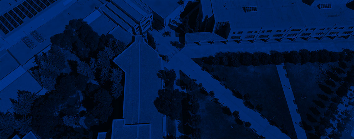
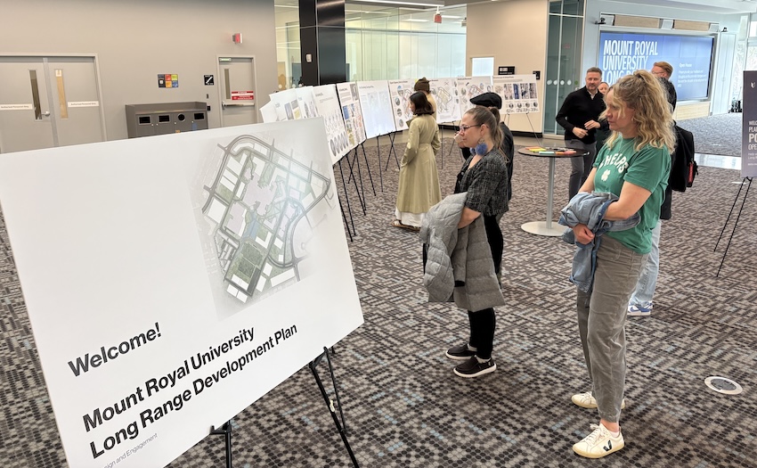
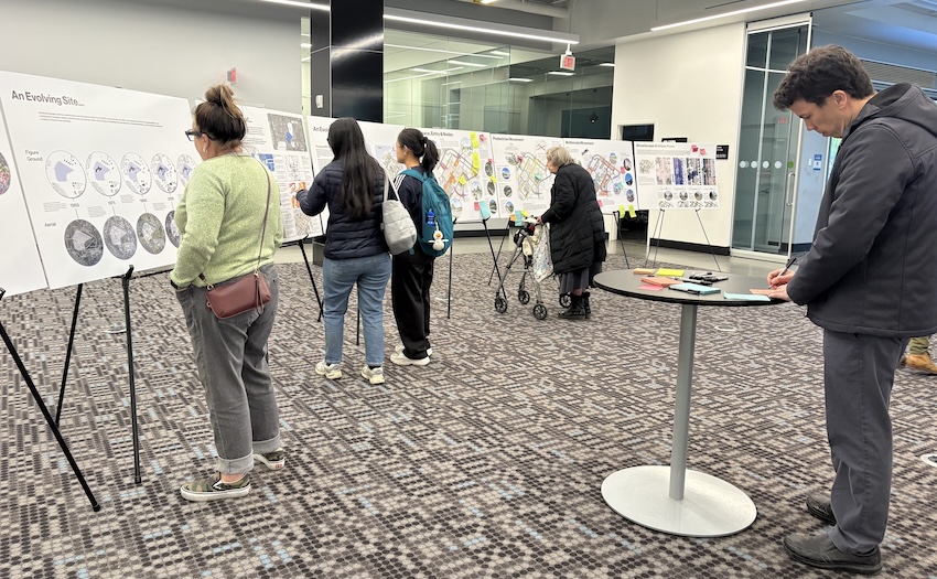
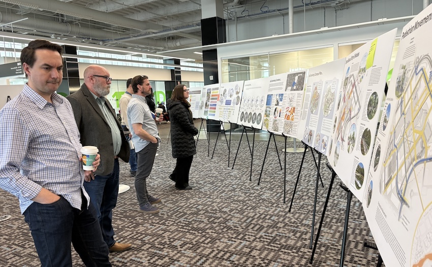
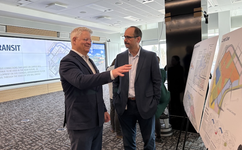
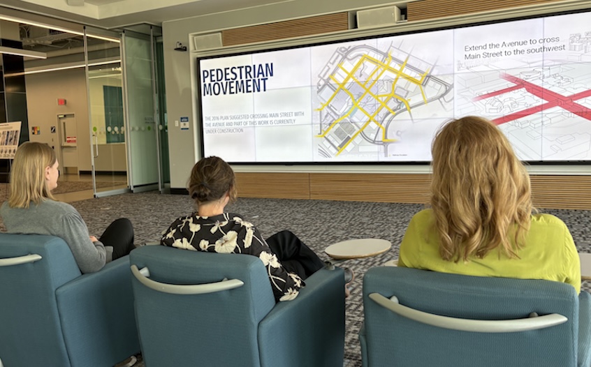
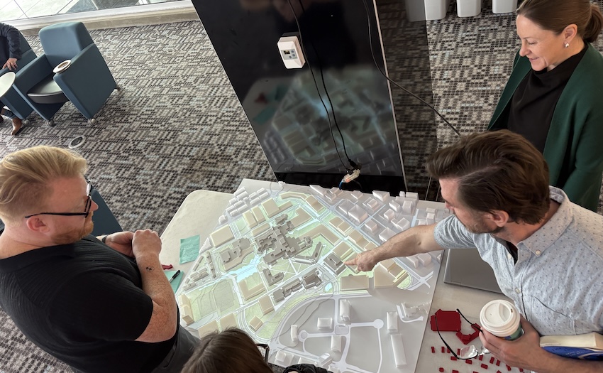
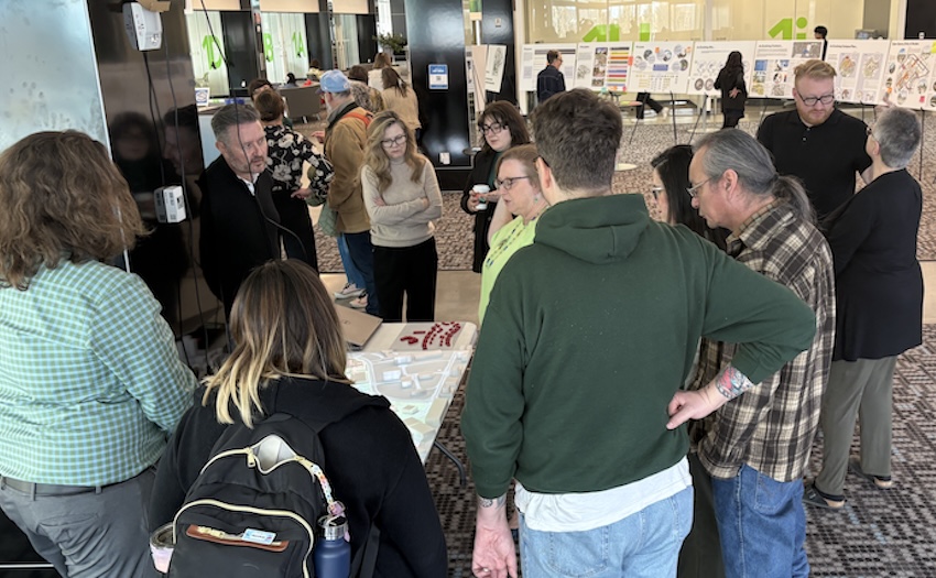
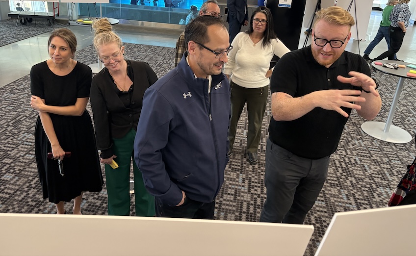
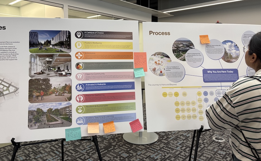
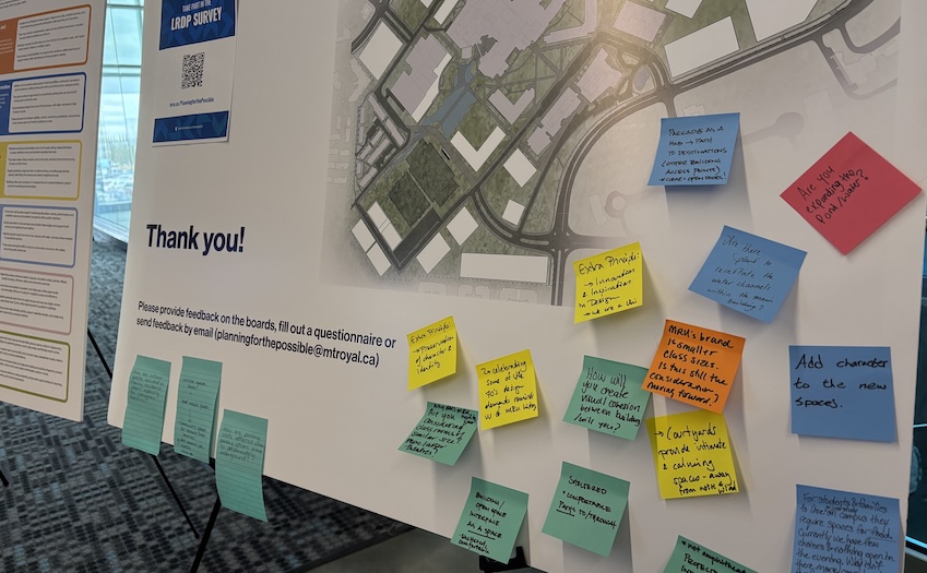
Photo 1: The first Open House for Mount Royal’s Long Range Development Plan was held in the Riddell Library and Learning Centre from noon to 8 p.m. on Tuesday, March 17.
Photo 2: Participants reviewed context along with the draft LRDP.
Photo 3: In addition to students and employees, the event was open to the public, who were notified of the Open House in community newsletters, social media ads, streetside advertising and more.
Photo 4: Member of Parliament for Calgary Signal Hill David McKenzie, left, chats with Mount Royal’s Boris Dragicevic, advisor, Major Capital Projects, during the Open House.
Photo 5: The draft LRDP was shared on the large visualization wall during the event.
Photo 6: Projections overlay a 3D model of campus, highlighting various patterns (pedestrian, vehicle, etc.) and potential areas of development and evolution (Residence district, perimeter, Main Building, etc.).
Photo 7: Participants review and discuss the draft LRDP concepts shown on the 3D model.
Photo 8: Tori McMillan, director of the Iniskim Centre, centre, discusses the draft LRDP with Stantec’s Kevin Mullin, principal architect, right, who is supporting Mount Royal’s LRDP process.
Photo 9: The draft LRDP was presented on information boards throughout the Ideas Lounge , including this one on the principles underpinning the Plan and how each principle is expressed through proposed changes.
Photo 10: Participants shared input via sticky notes on the draft LRDP information boards, as well as by speaking with project team members at the event. In addition, a week-long online survey gathered input on the draft Plan.
Stay
informed
Sign up to receive updates on Planning for the Possible, including timelines, draft concepts, Open House events and opportunities to provide feedback online. Mount Royal employees and students will automatically receive these updates through their mtroyal.ca accounts, so don’t need to sign up here as well. We respect your inbox and privacy. You can unsubscribe at any time.
Sign up nowWhere the rivers meet
Mount Royal University is situated on an ancient and storied land steeped in ceremony and history that, until recently, was occupied exclusively by people indigenous to this place. With gratitude and reciprocity, Mount Royal acknowledges the relationships to the land and all beings, and the songs, stories and teachings of the Siksika Nation, the Piikani Nation, the Kainai Nation, the Îethka Stoney Nakoda Nation (consisting of the Chiniki, Bearspaw and Goodstoney Nations), the people of the Tsuut’ina Nation, and the Métis.
As such, Mount Royal University is committed to advancing the success of Indigenous learners and respectfully supporting Indigenous cultural identities and integrity, leading to a good life in all its aspects. Mount Royal will challenge settler colonialism and systemic racism and discrimination by addressing the legacy of broken promises and rebuilding the relationships between Indigenous and non-Indigenous peoples. This includes those who now live at the confluence of the Elbow and Bow rivers, a place referred to by the Siksika Nation, the Piikani Nation and the Kainai Nation as Moh’kinstsis, by the Îethka Stoney Nakoda Nations as Wîcîspa, and by the Tsuut’ina Nation as Guts’ists’i. Mount Royal will meet these goals by committing to the Truth and Reconciliation Commission’s Calls to Action and adopting and applying the principles of the United Nations Declaration on the Rights of Indigenous Peoples.
View full land acknowledgementWhat is MRU’s LRDP?
Planning for the Possible builds on:
- MRU’s Vision 2030 Strategic Plan
- The Indigenous Strategic Plan
- Previous Campus Master Plans (2008, 2016)
- Key City of Calgary frameworks (e.g. Climate Strategy, RouteAhead Transit Plan)
Together, these plans emphasize sustainability, community integration, Indigenous inclusion and urban resilience.
This LRDP is a response to the evolving context since the last plan in 2016. It reflects how an urban MRU can grow within fixed boundaries, and it identifies opportunities to support:
- Financial sustainability
- Student experience
- Community connectivity
- Infrastructure resilience
Rather than prescribing specific buildings or uses, the LRDP defines potential building areas, land use types (e.g. academic/administrative, housing, mixed-use) and development guidelines. It focuses on how space between buildings functions, not just the structures themselves.
Planning principles
The LRDP is guided by four core principles (a consolidation of the eight principles from the 2016 campus plan):
- Land use and building potential
- Transportation access and circulation
- Pedestrian mobility and accessibility
- Open spaces and green corridors
Illustrated maps identify areas of change and highlight opportunities such as:
- Mixed-use development
- Activation of open spaces
- Vibrant pedestrian streets
- Perimeter density adjustments
- Smarter parking strategies
It also addresses challenges including limited campus boundaries, aging infrastructure, inactive frontages and disconnected buildings.
The broader context
The area surrounding MRU is becoming denser and more urban. This includes new roads, pathways and cycling infrastructure. According to area planning documents, this trend will continue, making it essential that MRU plans intentionally to remain integrated and connected.
Who’s involved
MRU has established a Steering Committee and a Working Committee, supported by planning consultants from Stantec. Engagement has included internal stakeholders and will expand to external communities, including local residents, Indigenous Nations and the City of Calgary.
Where we are now
Draft concepts were presented to the community at an open house on March 17, 2026 and posted online. In addition to feedback provided at the event, a weeklong online survey gathered input. The committees supporting the plan are reviewing public input and refining the draft plan accordingly. A second open house presenting concepts that integrate the feedback we receive in March will be held on May 5, 2026.
Questions?
You can reach us at PlanningForThePossible@mtroyal.ca.
Timeline
- Initial work:
2025 - March 17, 2026:
Open House 1 - Early 2026:
Integrating feedback - May 5, 2026:
Open House 2 - Mid 2026:
LRDP finalized
Initial work: 2025
Initial research, campus analysis and early planning. Development of draft LRDP concepts.
January 2026: Open House 1
An in-person Open House for the MRU campus community and external audiences (neighbours, businesses, Nations, community associations, government) to review draft concepts and share feedback. Noon to 8 p.m. in the Ideas Lounge (located in the Riddell Library and Learning Centre). An online feedback option will also be available.
February 2026: Integrating feedback
The Steering and Working Committees, with consultant support, reviewed public input and used it to refine the LRDP.
March 2026: Open House 2
This event will share “What We Heard” and how the LRDP has evolved in response. Updated plans are now available online and in person. Noon to 8 p.m. in the Ideas Lounge (located in the Riddell Library and Learning Centre).
Final steps to validate, receive approval from the Board of Governors, and begin integrating the LRDP into broader campus and municipal planning.